Orthomosaic Photography
Orthomosaic photography, often referred to as photogrammetry, is a technique used to create a detailed, geometrically accurate representation of a large property or industrial site by stitching together multiple aerial or satellite images. The orthomosaic is a distortion-free image where the scale is uniform across the entire surface.
Ideal for showcasing rural properties!
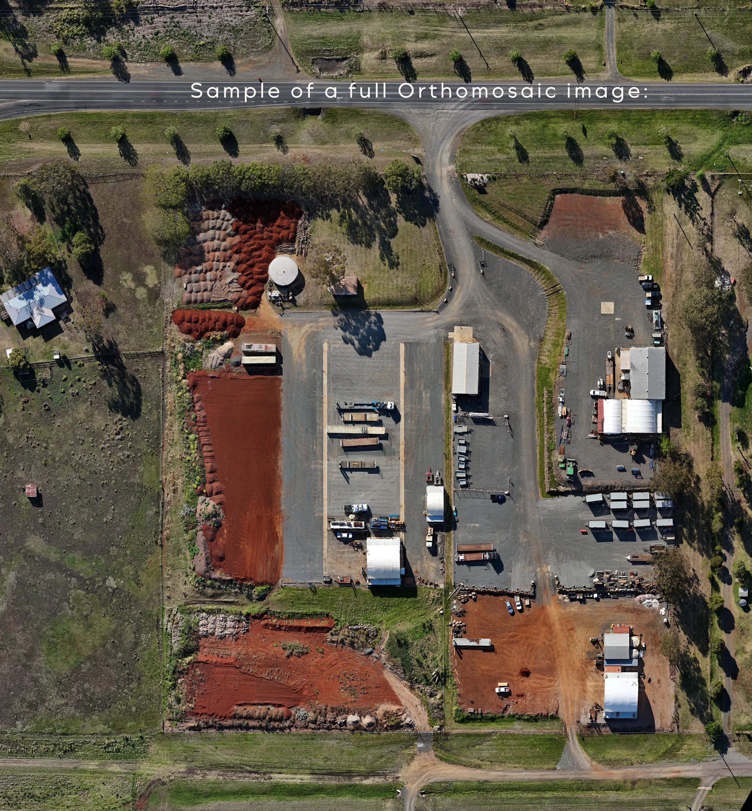
Orthomosaic Image - GoogleEarth similarity
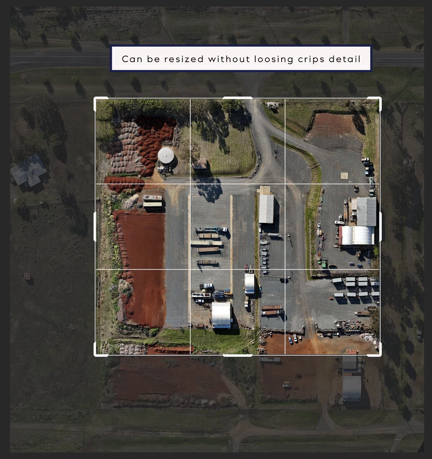
Resize without reduction of resolution
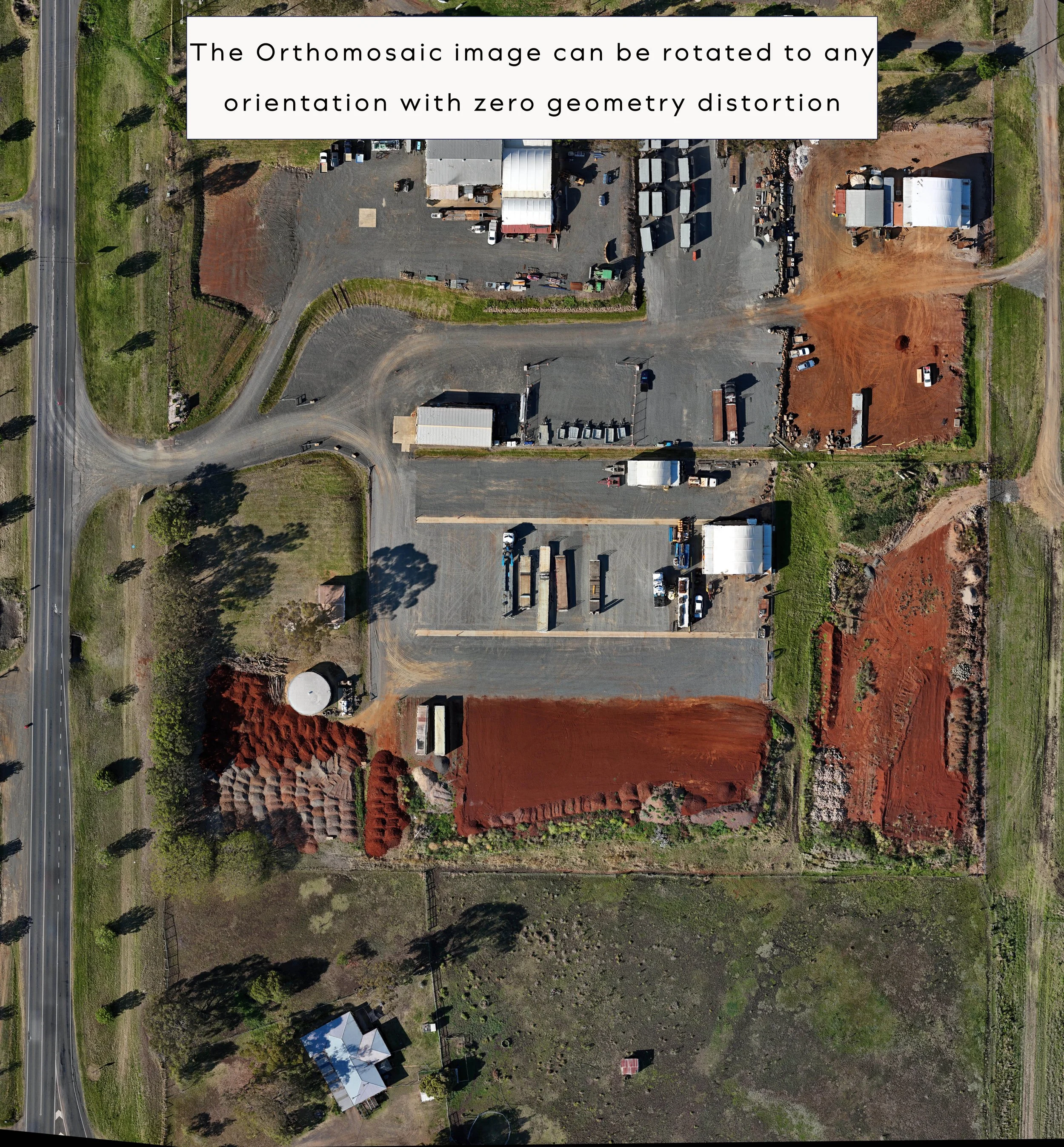
There is no geometric distortion with the Orthomosaic image
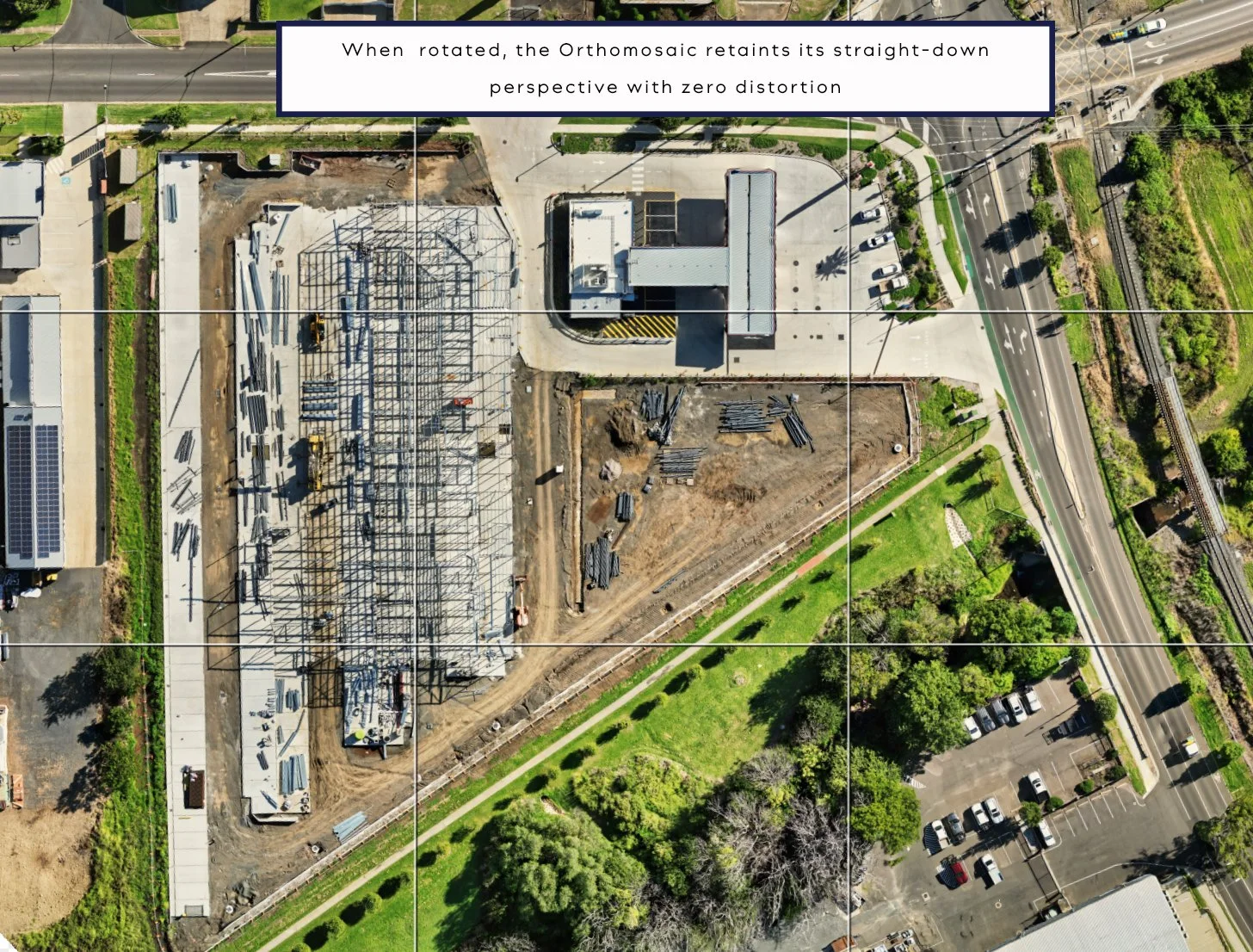
Orthomosaic - zero distortion of geometry in image

photogrammetry provides accurate details of commercial properties.
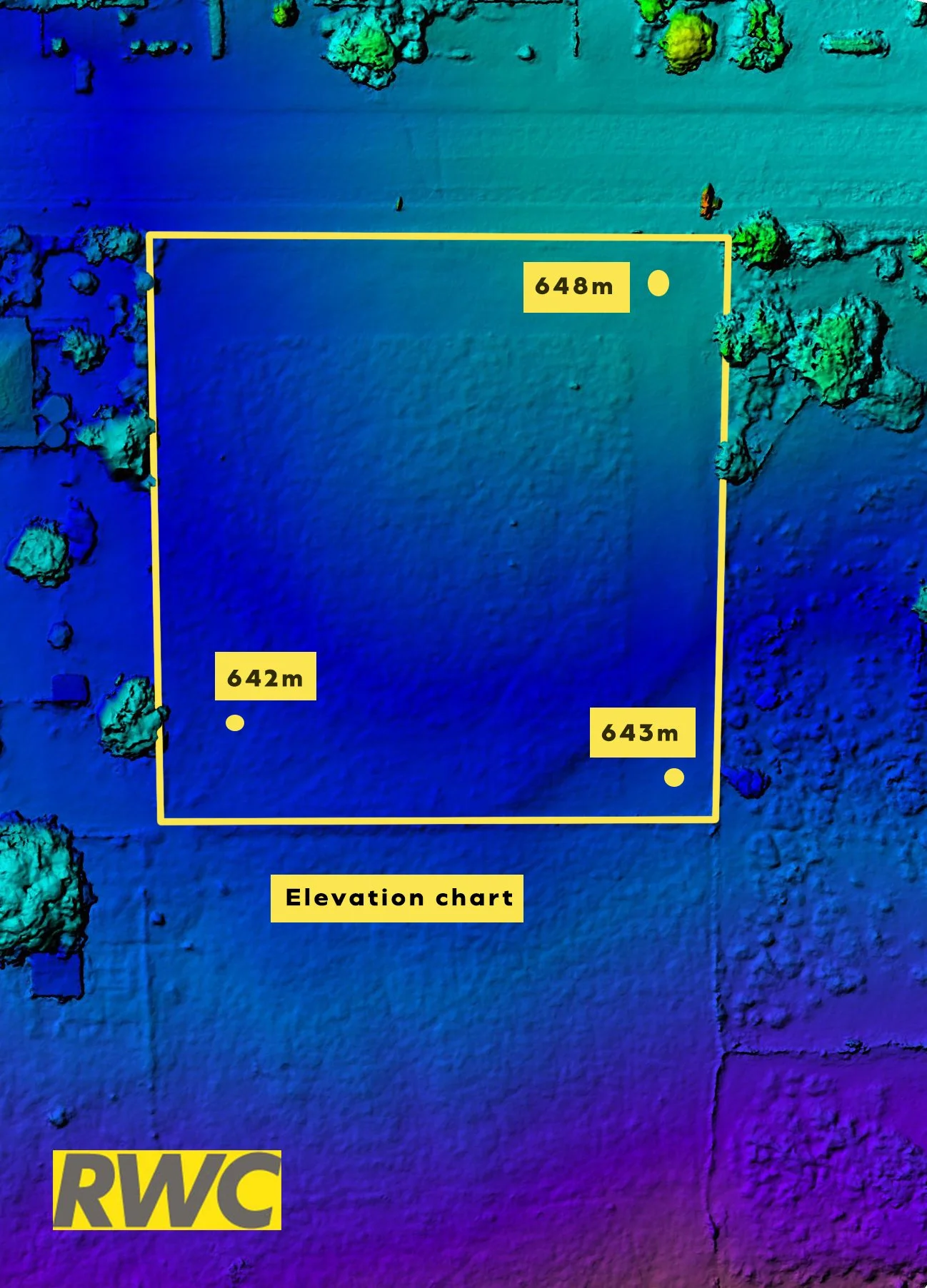
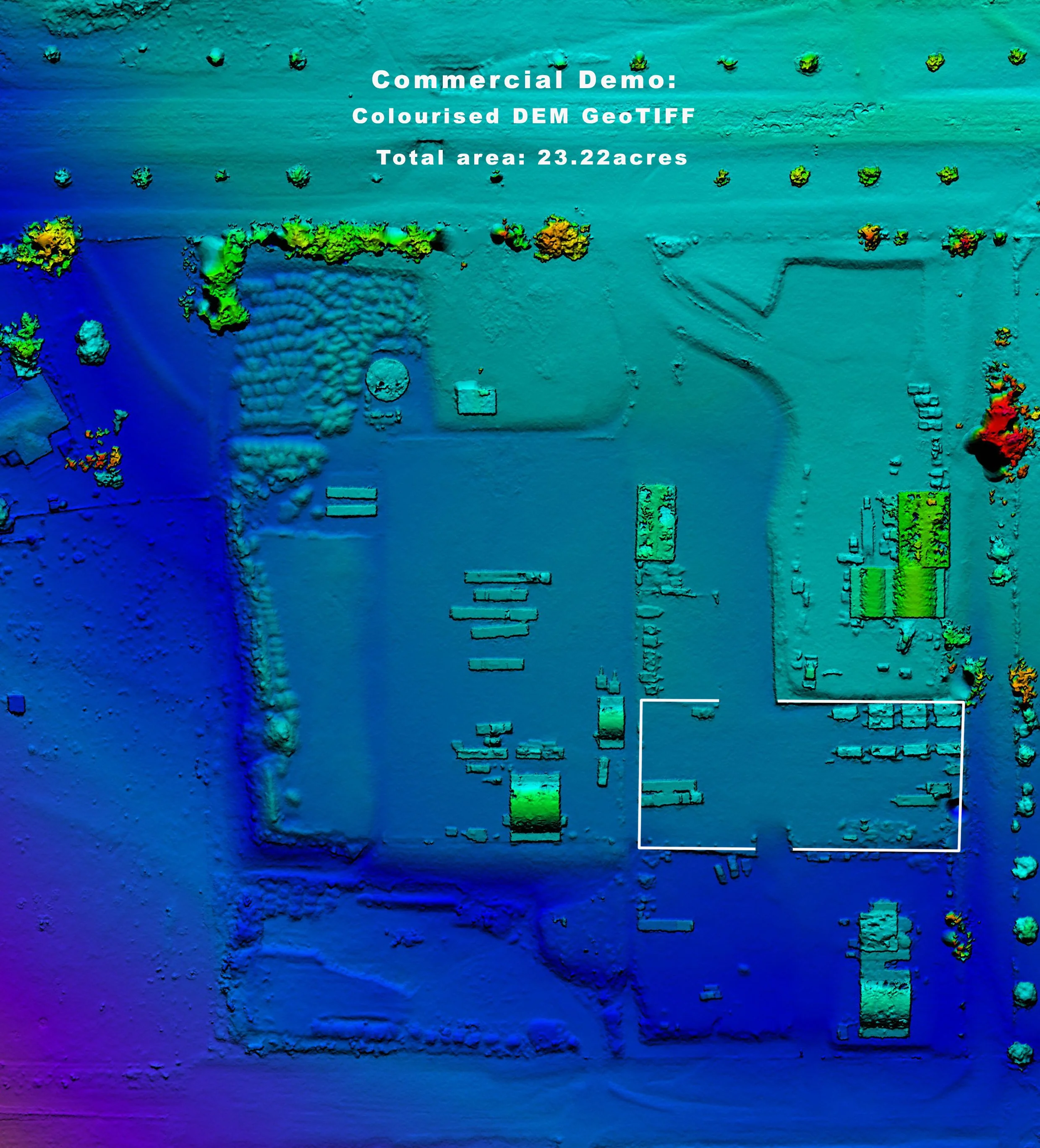
Photogrammetry provides digital elevation models which provides additional information about the property.


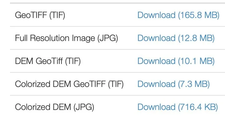
Extra Products included with each Orthomosaic
-
![]()
DEM file
Digital Elevation Model is included
-
![]()
Original files
All original files will be included in with each Orthomosaic scan.
- Full resolution TIF file
- Full resolution JPEG file
- DEM Geo TIFF file
- DEM Geo JPEG file
- Online links to 3D Model (public and private 3d viewers)
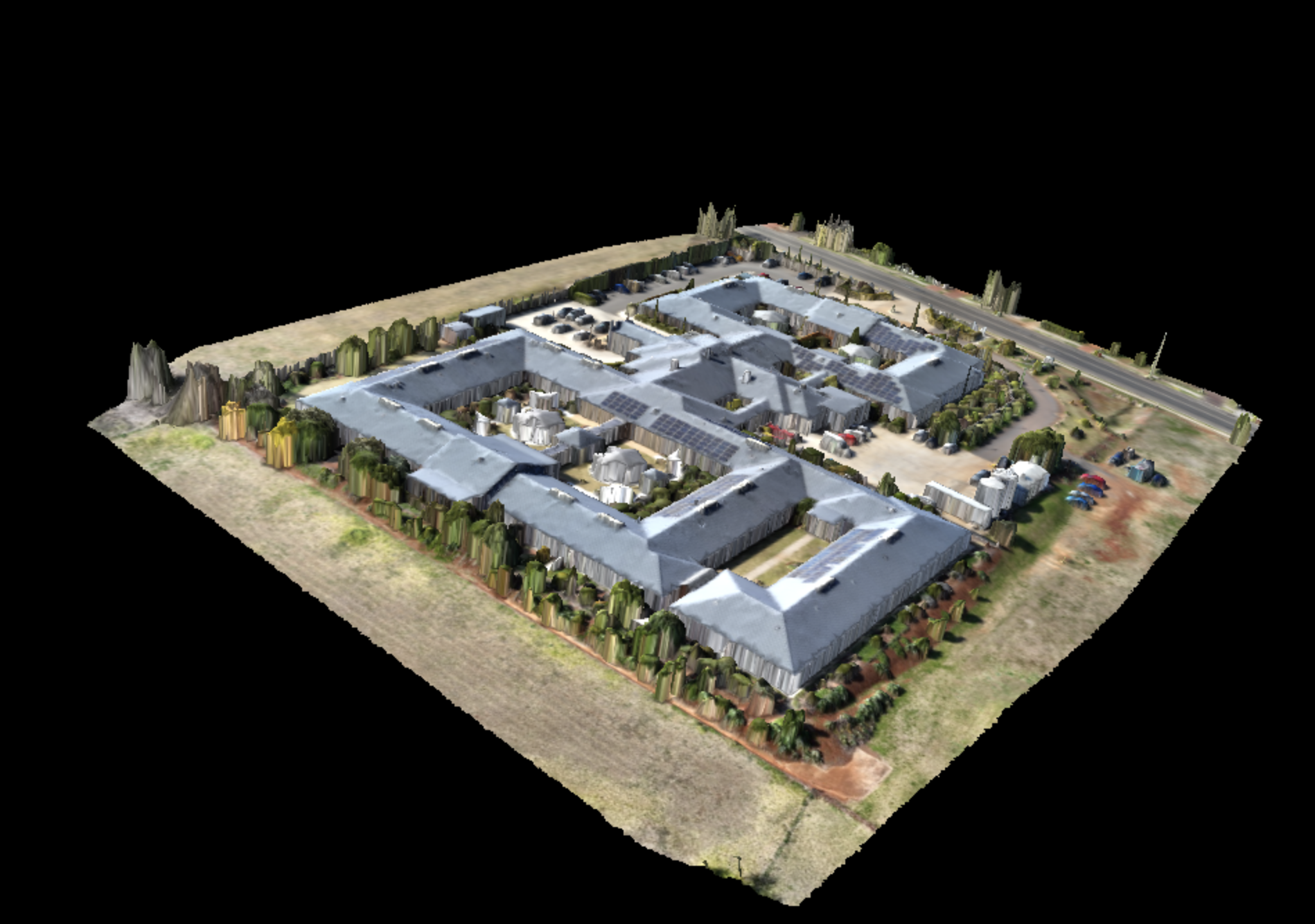
-
![]()
3D Model
The 3D model link is included.